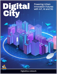
 In the heart of our rapidly urbanizing world, where over half of humanity now resides in cities, a quiet revolution is unfolding.
It is not heralded by the clamor of construction or the roar of traffic but by the seamless interplay of data, algorithms, and augmented reality (AR), weaving the physical and digital realms into a unified tapestry.
At the forefront of this transformation stands Niantic Spatial, a pioneer in geospatial artificial intelligence (AI), whose Large Geospatial Model (LGM) and Visual Positioning System (VPS) are redefining how we interact with, manage, and envision our urban landscapes.
A company once synonymous with Pokémon Go has boldly pivoted to form Niantic Spatial—a venture dedicated to geospatial AI. By leveraging vast datasets crowdsourced from millions of players, Niantic Spatial is crafting digital maps of unparalleled detail, poised to empower robotics, AR smart glasses, and autonomous navigation.
Platform for the Digital City
Imagine a city where planners can visualize the impact of a new transit hub before a single brick is laid, where maintenance crews are guided to a failing water main with pinpoint accuracy, or where residents explore their neighborhoods through immersive AR experiences that blend history, culture, and real-time information.
These are not distant dreams but tangible possibilities enabled by Niantic’s geospatial AI. Built on a foundation of over 30 billion posed images and a 3D digital map with centimeter-level precision—crowdsourced through games like Pokémon GO—this technology offers a dynamic, semantically rich understanding of urban environments. It is a tool that transcends traditional mapping, empowering cities to predict, adapt, and thrive in an era of unprecedented complexity.
The promise of smart cities lies in their ability to harness data for the common good, and Niantic’s platform is uniquely positioned to deliver. Its LGM creates digital twins of urban spaces, allowing planners to simulate scenarios, from traffic flows to environmental impacts, with unparalleled fidelity.
These virtual models, enriched by object-level details and street-scale insights, enable data-driven decisions that optimize land use, reduce carbon footprints, and enhance livability. Meanwhile, the VPS, with its six-degree-of-freedom (6DOF) tracking across millions of locations, supports real-time applications, from AR-guided emergency response to autonomous delivery robots navigating bustling streets.
Consider the potential for infrastructure. By integrating IoT sensor data with Niantic’s 3D maps, cities can predict maintenance needs—whether it’s a power grid under strain or a bridge requiring inspection—minimizing disruptions and extending asset lifespans. The platform’s on-demand mapping, capable of scanning landmarks like the San Francisco Ferry Building in mere minutes, ensures that urban data remains current, a critical factor in managing dynamic cityscapes.
Geospatial Innovations
For transportation, geospatial AI optimizes mobility, forecasting congestion or guiding last-mile deliveries through pedestrian-friendly zones. These advancements, detailed in the chapters ahead, illustrate how Niantic’s technology can make cities more resilient and efficient.
Yet, the true heart of a smart city lies in its people. Niantic’s platform fosters engagement through location-based AR experiences, from gamified community events to interactive public space guides, strengthening social bonds and civic pride. Real-time, hyper-local notifications—event alerts, safety warnings, or local business promotions—connect residents to their surroundings, while cross-device accessibility ensures inclusivity. This guide examines how such innovations can redefine urban life, making cities not just smarter but more human:
Urban Planning and Spatial Design: Niantic’s LGM creates semantically rich digital twins of urban environments, allowing planners to simulate and analyze proposed developments, traffic patterns, and environmental impacts before implementation. For example, digital twins can model how new buildings affect pedestrian flow or utility demands, reducing planning costs and improving stakeholder engagement through immersive AR visualizations.
Citizen Engagement and Immersive Experiences: Niantic’s platform can create location-based AR experiences to boost civic participation, such as interactive guides for public spaces, historical tours, or gamified community events, fostering social cohesion.
Transportation and Logistics Optimization: Niantic’s geospatial AI enhances traffic management and public transit by analyzing spatial dependencies and mobility patterns. Predictive models can forecast congestion or infrastructure stress, enabling dynamic rerouting of vehicles or optimization of bus schedules.
However, the path to this future is not without challenges. Privacy concerns, stemming from Niantic’s reliance on player-contributed data, demand transparent governance. Scalability remains a hurdle, as global coverage requires partnerships to fill gaps in less-mapped regions. Ethical considerations, including the technology’s potential dual-use applications, underscore the need for responsible deployment. These issues, explored with candor, frame the broader discussion of how cities can adopt geospatial AI thoughtfully, balancing innovation with trust.
As we stand on the cusp of a new urban era, our guide book invites readers—planners, policymakers, technologists, and citizens—to envision the possibilities of Niantic Spatial’s geospatial AI.
It is a call to action to harness this technology not as an end but as a means to create cities that reflect our highest aspirations: sustainable, equitable, and alive with possibility. Through case studies, technical insights, and visionary perspectives, we chart the course ahead, mapping not just our cities but the future itself.


